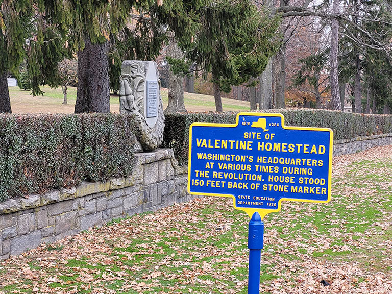
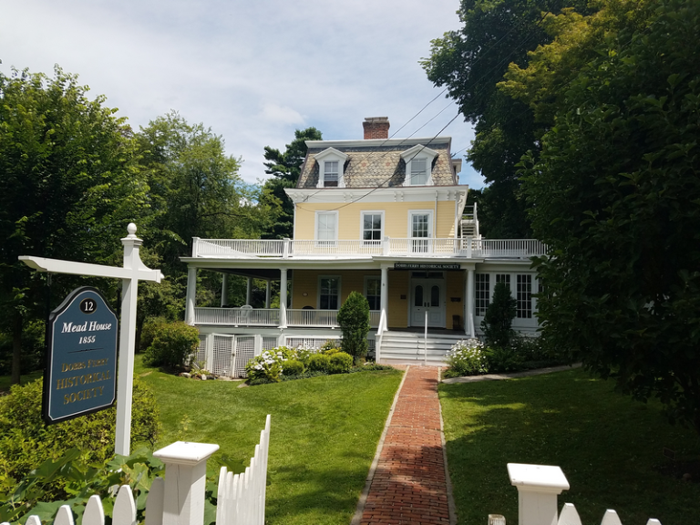
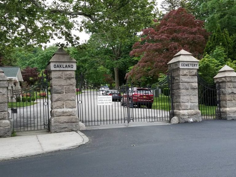
All Places Search for Near Search {"hide_search_input":"","hide_near_input":"","input_size":"","bar_flex_wrap":"","bar_flex_wrap_md":"","bar_flex_wrap_lg":"","input_border":"","input_border_opacity":"","input_rounded_size":"","btn_bg":"","btn_rounded_size":"","btn_rounded_size_md":"","btn_rounded_size_lg":"","bg":"","mt":"","mr":"","mb":"3","ml":"","pt":"","pr":"","pb":"","pl":"","border":"","rounded":"","rounded_size":"","rounded_size_md":"","rounded_size_lg":"","shadow":"","css_class":""} View: Grid 1 View: Grid 2 View: Grid 3 View: Grid 4 View: Grid 5 View: List Historical Society Favorite Yonkers, NY Historical Society The Yonkers Historical Society has an office in the Grinton I. Will Library. Generally, it appears, that you need to Read more... Historical Marker Favorite Valentine Homestead Site Historical Marker for the Valentine homestead . The Valentine homestead no longer exists.In 1922, the Valentine family donated their homestead Read more... Historical Society Favorite Dobbs Ferry Historical Society Dobbs Ferry Historical Society: Preserving the rich history of a small village Dobbs Ferry is a small village in Westchester Read more... Cemetery - Burial Sites Favorite Oakland Cemetery Oakland Cemetery in Yonkers, NY appears to have been established in 1866 as the Yonkers Cemetery Association and later re-named Read more... Historical Landmark Favorite Philipse Manor Hall Philipse Manor Hall is a historical landmark that holds significant importance for the American Revolution and the early history of Read more... Historical Landmark Favorite Nodine Hill Water Tower Yonkers, NY The Nodine Hill Water Tower, located on Prescott Street at the corner of Elm St, is an iconic landmark in Read more...